第313回生存圏シンポジウム
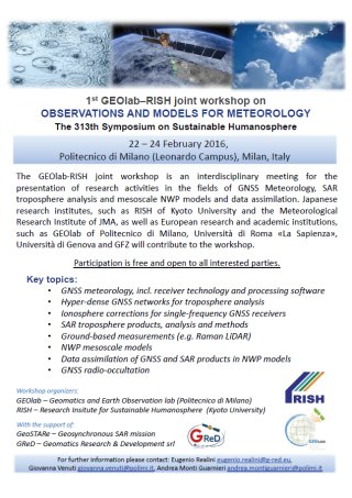
1st GEOlab-RISH joint workshop on OBSERVATIONS AND MODELS FOR METEOROLOGY
| 開催日時 | 2016(平成28)年2月22日(月)~24日(水) |
|---|---|
| 開催場所 | Politecnico di Milano (Leonardo Campus), Milan, Italy |
| 主催者 | 津田敏隆 (京都大学生存圏研究所大気圏精測診断分野) |
| 申請代表者 | 津田敏隆 (京都大学生存圏研究所大気圏精測診断分野) |
| 関連ミッション |
ミッション 1 (環境計測・地球再生) |
| 関連分野 | GNSS気象学。 |
目的と具体的な内容
GPSで代表される衛星測位システム(GNSS: Global Navigation Satellite System)の測位電波が衛星から地上に到達する間に大気・電離圏で生ずる伝搬遅延は、測位の誤差要因である。GNSS気象学は、この測位誤差から大気情報を抽出する新しい大気計測法であり、近年注目を集めている。特に、集中豪雨に関係する水蒸気の空間分布と時間変動を精密観測する研究に注目が集まっている。
近年、米国のGPSに加え、欧州のGalileo、ロシアのGLONASS、中国のBeido(北斗)が運用されつつあり、日本の準天頂衛星システム(QZSS)やインドのISROといったregional測位システムも開発されている。その結果、近い将来、東南アジア・インド域で最も多くのGNSSデータを利用できると予想されている。その利点を活かすため、GNSS気象学をアジア域に展開する事を目指し、研究成果の情報交換ならびに国際協力に関する意見交換を行う事が本研究集会の目的である。主な参加者は、GNSS気象学に関する2国間協力事業を実施しているイタリア・ミラノ工大の研究者や大学院生である。日本からは、生存研の大学院生4名と気象研究所の共同研究者が参加した。
生存圏科学の発展や関連コミュニティの形成への貢献
本ワークショップの主題であるGNSS気象学は、電波を利用した大気圏計測、及び現在の重要な宇宙システムであるGNSSに関わっており、生存圏科学の2つのミッションを基礎にしている。ワークショップでは、GNSS受信システムのH/W開発、信号・データ処理アルゴリズム開発、測位衛星データ利用等の幅広いコミュニティからの参加により、GNSS気象学の現状と将来指針に関する有益なBrain stormingが行われた。
今後、本研究集会で得られた成果を踏まえ、集中豪雨の監視及び予測精度の向上が期待される。活発な熱帯の積雲活動により集中豪雨が頻発しているにもかかわらず、定常気象観測網が十分でない地域にGNSS気象学が導入されれば、洪水災害の減災に強く影響すると考えられる。特に、イタリアでは、地震や火山の監視を目的にGNSS観測ネットワークが充実しつつあり、その衛星測位データを活用する事により、高分解の水蒸気分布の監視および、数値モデルへの同化により、集中豪雨の予測ができるようになると期待される。
プログラム
Monday 22
| Foreword | |
| 14:30–14:45 | RISH presentation (T. Tsuda) |
| 14:45-15:00 | GEOlab presentation (G. Venuti) |
| GNSS meteorology | |
| 15:00–15:30 | GPS/GNSS Meteorology in Japan: History and Achievements (Y. Shoji) |
| 15:30–16:00 | ASI/CGS products and services in support of GNSS-meteorology (R. Pacione) |
| 16:00–16:30 | Coffee break |
| 16:30–17:00 | Ground based water vapor retrieval in Antarctic coastal areas (M. Negusini) |
| 17:00–17:30 | PWV time series from 1998 to 2015 on Ligurian area (I. Ferrando) |
| 17:30–18:00 | Characteristics of tropical convection in Indonesia from a coordinated campaign with X-band radar, GNSS-PWV, and radiosonde observations (M. Oigawa) |
Tuesday 23
| Hyper-dense GNSS networks for troposphere estimation | |
| 10:00–10:30 | GNSS meteorology by low-cost equipment (E. Realini) |
| 10:30–11:00 | Hyper-dense GNSS networks for troposphere analysis experimental set-up up of the Uji network (N. Ito) |
| 11:00–11:30 | Coffee break |
| 11:30–12:00 | PWV variations with the Uji network and data assimilation into a non-hydrostatic numerical model (M. Oigawa) |
| Innovative GNSS receiver technology and data processing | |
| 12:00–12:30 | Reconstruction of anisotropic slant total delays from GNSS observations (G. Moller) |
| 12:30–13:00 | TBD (A. Consoli) |
| Ionospheric delay estimates and models | |
| 14:30–15:00 | Real-Time Detection of Earthquake Ionospheric Disturbances through a Variometric Approach: a Preliminary Feasibility Demonstration with VADASE (A. Mazzoni) |
| 15:00–15:30 | Global TEC map based on new mapping function (Z. Deng) |
| 15:30–16:00 | Ionosphere corrections for single-frequency GNSS receivers time and spatial variations of TEC observed with the Uji network (Y. Takeda) |
| 16:00–16:30 | Coffee break |
| SAR troposphere products, analysis and methods | |
| 16:30–17:00 | Atmospheric water-vapour from spaceborne Interferometric SAR imaging (N. Pierdicca) |
| 17:00–17:30 | TBD (A. Monti-Guarnieri) |
Wednesday 24
| NWP models | |
| 10:00–10:30 | TBD (Emanuela Pichelli) |
| 10:30–11:00 | Preliminary studies on the integration of GPS and ECMWF to derive high spatial and temporal resolution water vapor maps (M. Capponi) |
| 11:00–11:30 | Coffee break |
| Innovative GNSS data processing and analyses | |
| 11:30–12:00 | Atmospheric water vapor monitoring from local GNSS networks: comparisons of GNSS data adjustment strategies (G. Venuti) |
| 12:00–12:30 | A non-tomographic estimation of 4D water vapor variation using the ground observation networks of specific humidity and GNSS (Y. Shoji) |
| 12:30–13:00 | Status of GFZ Multi-GNSS product GBM/GBU (Z. Deng) |
| GNSS radio-occultation | |
| 14:30–15:00 | Gravity waves in the stratosphere with COSMIC GPS-RO data (T. Tsuda) |
| Ground-based measurements | |
| 15:00–15:30 | Measurements of atmospheric temperature and water vapor with a ground-based Raman lidar (Y. Okatani) |
| 15:30–16:00 | Coffee break |
| Round table on future collaborations and funding opportunities (e.g. H2020) | |
| 16:00–16:30 | Open discussion (moderator: A. Monti-Guarnieri) |

Poster PDF file (192 297 bytes)
ページ先頭へもどる
2016年3月11日作成,2016年3月18日更新
